20 Apr The Impossible Railroad
John D. Spreckels was a man who had it all. By the 1890s he was richest man in San Diego, the publisher of most of its newspapers, the owner of Coronado Island and the ferry connecting it to the mainland, the proprietor of Belmont Park, and the Coronado and Golden West Hotels. He had thousands of people on his various payrolls, and paid one out of every ten property tax dollars collected in the county.
Spreckels was more than a wildly successful entrepreneur; he was also a civic promoter and benefactor, the man who enhanced the cultural life of his community by building Balboa Park and the Spreckels Theatre, the first modern playhouse west of the Mississippi. His biographer called him “one of America’s few great Empire Builders who invested millions to turn a struggling, bankrupt village into the beautiful and cosmopolitan city San Diego is today.”
However, the one thing Spreckels could not easily procure was the respect San Diego needed to be considered the equal of its more established California rival up the coast. Los Angeles had extensive road and rail connections to the lucrative markets to the east, while San Diego had what seemed to be an intractable mountainous terrain blocking the way. Spreckels aimed to conquer the rugged peaks and forbidding desert temperatures of the Laguna Mountains when he built what was to be called “The Impossible Railroad.”
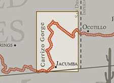
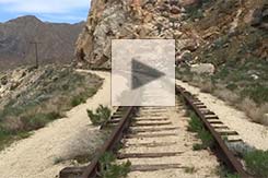
Explore the railway from the Goat Canyon Trestle southwest to the railyard at Jacumba and northeast to Dos Cabezas. Use the red hotspots to navigate through the virtual-reality panoramas and explore other features. There are 48 VR locations in the tour. The tour works best on a desktop computer, especially if you double-click to enter “full-screen” view, which also opens the navigational map. Click the “M” button to toggle the map.
Spreckels’ endeavor was, in part, prompted by the introduction of crop irrigation into the California desert wasteland near the Mexican border, now known as the Imperial Valley. This spawned the towns of Brawley and El Centro, soon followed by the arrival from the north of the Southern Pacific Railroad. John Spreckels was quick to see the commercial possibilities of a link between San Diego and the farms of the Imperial Valley, and ultimately the markets of the Eastern United States. He acquired the means to proceed when he convinced the Southern Pacific to become a silent financial partner of this new railroad venture across the 60 miles of mountain ranges that separate the two locations.
Spreckels was granted a charter for his San Diego and Arizona Railway (SD&A) on December 14, 1906. But it wasn’t until November 15 of 1919 that the first passenger train, called the “Golden Spike Limited,” pulled into San Diego’s Union Station from the eastern terminus of the line in El Centro. John D. Spreckels himself drove in the $286 golden spike, near tunnel #11.
He proclaimed the event the happiest moment of his life. The construction had taken 13 years due to the engineering challenges, particularly the extremes of desert heat and cold. There were flash floods from ferocious thunderstorms during late summer monsoons. And all the tunnels had to be bored through the unstable, loose rock of prehistoric landslides. There were also cost overruns and attacks by revolutionaries on the route segment through Mexico. The line contained a full three miles of tunnels, 21 in all. There were also 2.5 miles of bridges and trestles. Due to the desert heat, soaring to more than 110ºF, along with the smoke entering the open windows of the cars while transiting the tunnels, the tortuously slow pace through the curved and trestle-filled Carrizo Gorge prompted many to refer to the SD&A as “Slow, Dirty, and Aggravating.”
According to a passenger’s account of travel through the gorge, “the siding at Carisso [sic] Gorge stands without a station today because in a violent wind storm a number of year ago the building was blown over the edge of the 700-foot cliff and completely destroyed. This happened moments after the operator, scared by the shaking of the structure, had dashed outside.”
The original estimate for construction of the 146.4 miles of track was $6 million. But by the time the line was completed in 1919 costs had soared to some $18 million (nearly $301 million in 2022 dollars). The most agonizingly difficult challenge for the construction engineers was the 11-mile segment through Carrizo Gorge, which included 17 tunnels, totaling 13,385 feet in length.
SD&A timetable, c. 1922
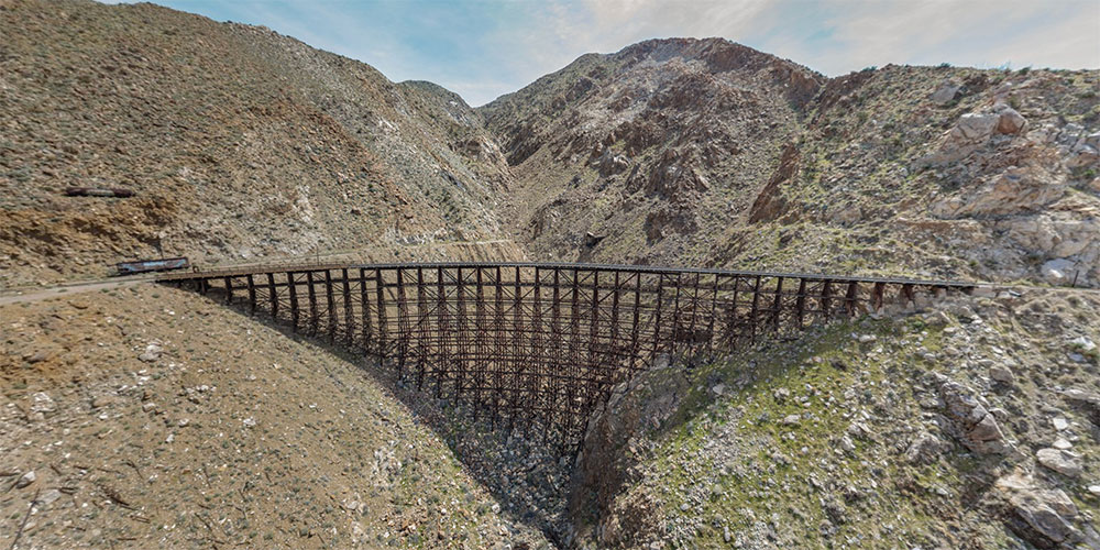
One tunnel in particular would prove especially troublesome, resulting in what would become the spectacular and iconic Goat Canyon Trestle. This trestle may be explored at the beginning of the virtual-reality tour of Carrizo Gorge featured above.
On March 27 1932, a temblor produced a rock slide in the gorge, causing a sudden collapse of parts of Tunnels 7 and of 15, and taking them out of commission. The company decided not to attempt to repair the tunnels because their walls and roofs had been blasted out of heavily fractured rock. Instead the railroad built a curvy bypass route to take the place of Tunnel 7. For Tunnel 15, which took the line across Goat Canyon, the railroad eliminated the greater part of it, shrinking the tunnel from 937 feet to 178 feet. This was accomplished by the construction of a 633-foot-long wooden trestle to span Goat Canyon, the floor of which was a dizzying 185 feet below the rails. Making the most of this costly ($319,771) 1933 engineering marvel, the company began to brag about it, claiming (erroneously) that passengers would be able to ride across “the highest and longest wooden trestle in the world” in what was to be marketed as the “last transcontinental railroad.” In 1986 the trestle was designated a Historic Civil Engineering Landmark. The Goat Canyon Trestle may be seen here in a satellite view.
Wooden trestles, especially with spark-spewing steam locomotives in the oven-like summer climate of the Mohave Desert are always a fire hazard. To mitigate this danger, the Goat Canyon trestle was constructed with an elaborate system of water pipes and valves, all connected to a large water tank on the hill above the trestle. The engineering diagram for this system may be seen in the gallery below. As added insurance, the company mounted a fire engine (in gallery below) on flanged wheels and stationed it at the ready at its Jacumba depot at the southern approach to Carrizo Gorge.
Landslides and weather continued to play havoc with the railroad, which was taken over completely by the Southern Pacific in 1932 and renamed the San Diego and Arizona Eastern. Passenger car service was ended in 1951, after washouts and floods near Tunnel 8 and 10 shut down the line for an extended period while repairs were made.
All rail traffic was halted for five years after the remnants of Hurricane Kathleen devastated the route in September of 1976. Canyon trestles were washed away when more than a foot of rain fell in some areas, causing catastrophic destruction to nearby Ocotillo, where six people drowned. Three trestles were completely washed away, and five others were damaged. In addition, there were some 50 washouts and rockslides.
Frank Waters, The Colorado; Rivers of America Series
The hurricane’s awesome power was described by Kit Courter in 2004. Courter’s photographs of the aftermath may be seen in the links:
“In September of 1976, Hurricane Kathleen roared up the length of the Gulf of California between Baja California and the Mexican Mainland, and before it was finished, it dumped a good dozen inches of water on the Imperial Valley of California within only a very few hours…It left one whole side of Interstate Highway 8 along Meyer Creek…fully missing for several miles…It left the center of the town of Ocotillo washed away or buried in sand. The right-of-way of Southern Pacific’s San Diego and Arizona Eastern Railway stood in the path of this storm, and was subjected to tremendous flash floods at even small canyon crossings. In many places, the line was either buried in mud, as between Jacumba and Dubbers, or washed away. Huge rocks were undermined by the floodwaters and then fell on the rails. A track inspector sent into the gorge to survey the situation during the storm had to abandon his inspection car when it was marooned between two rock slides; he then had to hike back to Dubbers over several miles of line containing serious washouts with up to an eighth-of-a-mile of rail left hanging in the air.”
The Carrizo Gorge section of the line was subsequently battered by years of violent storms. In 1979, faced with a daunting estimate of $1.27 million to repair a line that was already hemorrhaging money each year, the Southern Pacific pulled the plug on its Impossible Railroad. In 1979 they sold it to San Diego’s Metropolitan Transit Development Board (MTDB) for $18.1 million, and agreed to first restore the line to operational status.
The MTDB originally picked Kyle Railways to operate the SD&AE, and for two years Kyle ran freight through Carrizo Gorge, but this arrangement fell apart in 1983 after two of the trestles were destroyed by fire, followed by the collapse of half-mile-long Tunnel 8. The next corporate entity to attempt a revival of the line was the San Diego and Imperial Valley Railroad (SDIV). But it balked at the price tag for repairing the tunnels and bridges in Carrizo Gorge. Owners of a local construction company, however, felt that they could take on the repairs themselves, and negotiated trackage rights from SDIV in 2003 that allowed them to operate on the line as the Carrizo Gorge Railway.
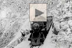
The railway had some initial success hauling sand for mixing concrete from Mexico to San Diego. But in October 2008, with such deteriorated rails, tunnels, and bridges, the route was embargoed for all revenue traffic. Stephen Hager filmed this cab ride on a maintenance train eastbound through Carrizo Gorge in April of 2012 on what was to be one of the last times the railway ran a train through the Gorge. The train enters the Carrizo Gorge around 12 minutes into the video.

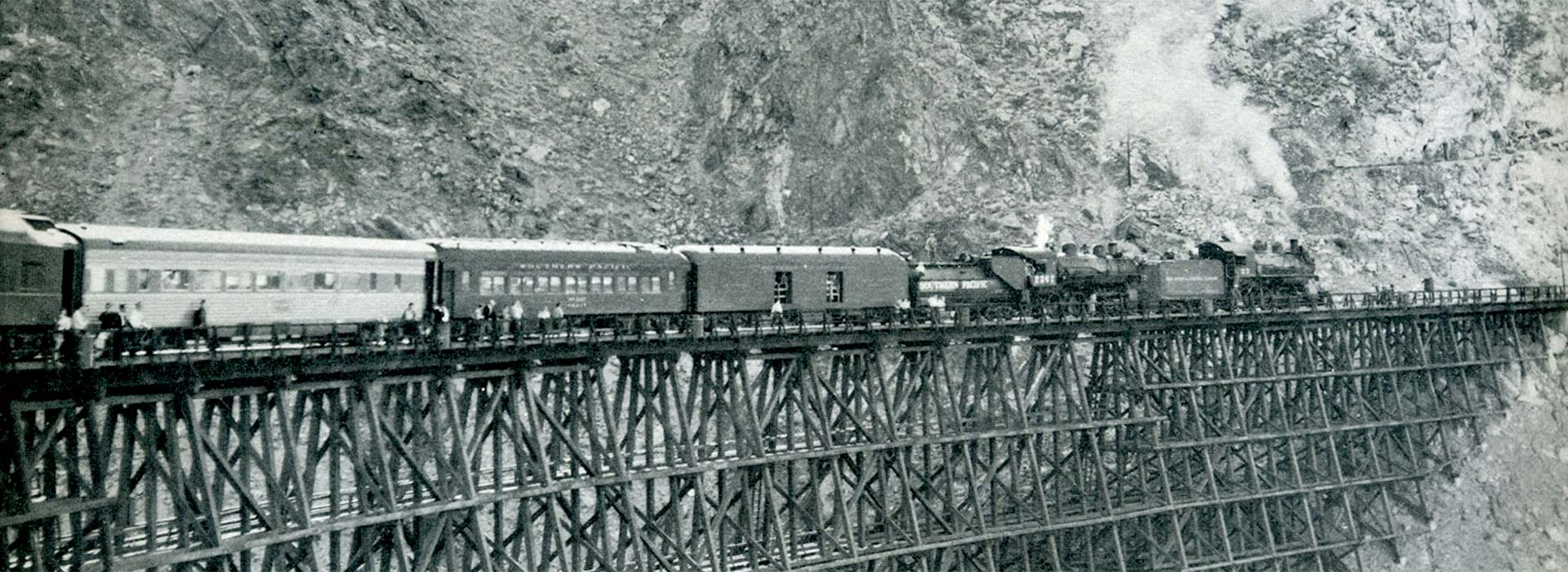
A special excursion train in 1947 stopped on the Goat Canyon Trestle to allow passengers a better view.
In December 2012 the MTDB ended its arrangement with Carrizo Gorge Railway and entered into a 99-year operating lease for its Desert Line with a new entity, the Pacific Imperial Railway, for freight operations. The lease stipulated operating goals and repair timetables (very few of which were ever met). The new railway had, however, usually been able to make its annual $1,000,000 payment to MTDB for the right to operate on the line. These payment, it seems, kept the folks in San Diego satisfied. The principals also made headlines for their financial shenanigans, labor law violations, and for the 220 lbs. of marijuana discovered hidden on a freight car, for which the company was fined $1.6 million. The Pacific Imperial Railway contended that there had been some progress on rehabilitating the eastern end of the line, as well as a financial restructuring and transfer of ownership. However, most observers doubted that revenue freight would ever again traverse Carrizo Gorge.
After the bankruptcy of Pacific Imperial Railway, the lease was taken over in 2016 by a Mexican entity, Baja California Railroad. Rehabilitation of the line was supposed to have been completed by the winter of 2018, but there is no evidence of any progress in Carrizo Gorge (2022). The company stopped making its lease payments to the MTDB in January 2020; its lease was terminated in August of that year. Now there is no operator in sight to make—or break—promises to repair the Desert Line.
Exploring Carrizo Gorge
Carrizo Gorge is almost entirely contained within California’s Anza Borrego Desert State Park. From one of the park’s highest viewpoints, Sacatone Overlook, you can see seven trestles of the railroad as it snakes its way through Carrizo Gorge in the distance, with the Salton Sea at the horizon. These trestles are known as the “Seven Sisters,” and may be seen below in a gigapixel panorama composited from more than 300 images.
While the state park may surround it, the railroad line itself is a long linear island of private property. There is no way to explore Carrizo Gorge that is completely without risk, physical or legal. Hiking into it on an ill-defined trail from Mortero Palms, while legal, is not for the casual hiker. The elevation gains, the summer heat and/or storms, the rattlesnakes, the Cholla cactus, and the Cat’s Claw bush (Acacia greggii, also known at the “wait-a-minute bush”) will make the trip challenging. It is much easier to hike on the tracks, either starting from the north at Dos Cabezas or from the south at De Anza Springs.
We walked and made virtual-reality panoramas of the southern half of the line through Carrizo Gorge in March 2015, leaving our car here, just outside the gates to the resort at De Anza Springs. Walking the nearly-level RR grade is not strenuous, but when crossing the many trestles you will be high above the canyon in some places. On some of the trestles the metal grate walkways on the inside edge of the canyon have been damaged by rock slides. It may be best to walk on the walkways on the outer edge of the trestles, vertigo be damned. The shorter trestles are lacking the walkways, requiring stepping carefully from crosstie to crosstie; in places the spacing between them is irregular.
We photographed the northern half of the Gorge most recently in March 2022, driving our 4WD high-clearance vehicle (required) from Borrego Springs. We turned SW on Mortero Canyon Road here, where it begins off of Sweeney Pass Road (Imperial Highway, or S2). Just before reaching the water tower the road intersects with Dos Cabezas Rd, where we turned north. We parked at this point and walked through the wash under the small trestle to begin our hike. The actual “road” begins here, and intersects here with the tracks west of the locked tunnel #18. This is about an 8-mile round trip hike. You can shorten the hike by about 3 miles if your vehicle is able to cross the tracks here, and continue along the hiking road until you deem it impassible.
Alternatively, if coming from the Ocotillo exit on I-8, you can turn directly onto Dos Cabezas Road from S2.
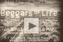
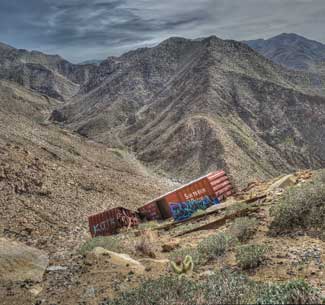
On the northern segment of the canyon you will note a couple of places, far below at the bottom of the gorge, where freight cars have fallen off the tracks. Some are the remnants of a 1928 movie, Beggars of Life, shot in the Gorge. Scenes from the film are excerpted on this page, above left. Another two boxcars careened down into the gorge filled with trailer loads of Coors beer, to the delight of many. Yet another wreck left a hillside littered with precast concrete beams.
You will also encounter on the southern section of the canyon two different sets of “ghost trains,” abandoned passenger cars purchased by the Carrizo Gorge Railway in anticipation of commuter service between Tijuana and Tecate in Mexico, or perhaps for taking tourists through the Gorge. In the virtual-reality tour at the top of the page, clicking the map hotspot at De Anza Springs will take you to the five cars of the Chicago Metra line, vandalized and covered in graffiti. Coupled to the end of the Metra cars is a flatcar with a tall wooden platform, used by the railroad to inspect the ceilings of the many tunnels. This may be seen in the gallery below. As we walked through the tunnels it became clear that tunnel inspections were sorely needed, as the tracks were blocked in some places by giant boulders which crashed down from above, hopefully when no hikers were anywhere nearby. The third map hotspot north will bring you to another railcar graveyard of three derelict and vandalized cars. These are the STCUM cars (Société de transport de la Communauté Urbaine de Montréal).
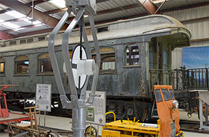
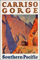
John D. Spreckles ornate business car, the Carriso Gorge, is on display at the Pacific Southwest Railway Museum. Click to learn more, and to enter the car in virtual reality.
The walk from De Anza Springs to the Goat Canyon Trestle and back is 14 miles. A round-trip hike from the end of the road at Dos Cabezas to the trestle is 10 miles. It took us two visits (in two different years) to walk all 24 miles. If you have two 4WD vehicles, and start early in the morning, a bit of car-shuttling would allow you to hike the 12 miles through Carrizo Gorge in one day. Leave one car at the end of Dos Cabezas Road, then drive in the other car to De Anza Springs. Begin your hike there, walking the rails the 12 miles northeast to your vehicle at Dos Cabezas, and plan to drive out on the Dos Cabezas Road while you have some daylight remaining. Then retrieve your other vehicle at De Anza Springs, where you can celebrate your accomplishment with a libation at the “Come-As-You-Are Bar” at the clothing-optional De Anza Springs Resort.
Some folks enjoy mountain biking or railbiking on the right-of-way. Trails running on the hillsides parallel to the railroad, built by construction crews, are used today by hikers and mountain bikers. Don’t try this one.
Hikers and bike riders are in danger from the potential (however remote) of railroad operations, and the various operators of the line claimed that they would cite and fine trespassers. So nothing on this website should be construed as encouraging or suggesting a violation of the property rights of the railroad operators. However, before we began our hike we asked a uniformed San Diego County police officer in Jacumba if a hike on the rails was advisable, and he said, “Sure. No problem. Take plenty of water and a flashlight for the tunnels.”
Sometime in late 2016 or early 2017 the east entrance to tunnel 16a (immediately east of the Goat Canyon Trestle) collapsed. There is a hillside path around the tunnel.
One way—entirely safe—to explore Carrizo Gorge is to visit the model railway at San Diego’s Balboa Park, the park endowed by John D. Spreckels. There, the scene replicates one particular day in 1949 along the San Diego & Arizona Eastern Railway.
The gigapixel panorama below shows the “Seven Sisters” trestles of the railroad in Carrizo Gorge, as seen from the Sacatone Overlook.
To explore the scene in detail, click the full screen button, and then zoom in by clicking in the image, or by using the buttons provided.
The Salton Sea can be seen far in the distance. Zoom in to find the wrecked freight cars below one of the trestles.
External Links:
Anza-Borrego Foundation
Pacific Southwest Railway Museum Association
Video Tours of Carrizo Gorge
“The Impossible Railroad” book (2011)




Michael Woodward
Posted at 12:08h, 06 MayCan a SxS make the trip along the tracks?
Howard Goldbaum
Posted at 08:23h, 10 MayThe many trestles would make this highly problematic.
Ian Grist
Posted at 14:49h, 19 NovemberI’m the one who’s ride report on ADV Rider you linked in your article here. Happy to see you used it as a reference! If you have any questions about the ride or anything, I’m happy to help, or provide additional info, details, or pictures if you need them!
David calvert
Posted at 21:03h, 28 SeptemberIn the winter of 83 i rode that train from Placerville to ysidro. The most incredible train ride of my life. 3 ingines pulled 5 box cars. Their was a coors trailer that had slid part way down the mountain and it looked then as if it had not been opened. I wanted to jump off and make a home in that trailer that i i agined to be full. Ill tell you something. Way down in that gorge is a train. Engine, passenger cars and caboose at the bottom. Looks like its from the 20s or 30s. That gorge has big magic.
Michael Reading
Posted at 19:36h, 14 JanuaryJust one comment/correction The Gold Spike of the SD&A Railroad was driven by Spreckels
on November 15, 1919. The first Revenue trains ran the first week of December 1919!
The location was actually between Tunnels 11 and 12 at about Mile Post 100.7
This was the site of Carriso Siding that was added after the railroad began operating.
Michael
Howard Goldbaum
Posted at 06:55h, 16 JanuaryThanks, Michael. Edits made.
Chris Jones
Posted at 16:52h, 14 MarchThat’s awesome that the Jacumba police officer was cool with you walking the tracks. I think the best route to Goat Canyon trestle is along the tracks from a small dirt road west of Dos Cabezas that terminates at the tracks between the first two tunnels going south. It’s 3.3 miles one way, crossing the seven trestles and passing through several tunnels (or around on the trail used by workers building the line).
Cliff W.
Posted at 12:42h, 06 OctoberI have wanted to hike this Goat Canyon Trestle for the past two years, but always hesitate because of some articles stating that it is illegal to hike through the 12 miles rail road.
I finally made up my mind to do this hike in a couple days. Do you by any chance have any information and update from the legal authority / police / railroad police about this route? After reading your article and you mentioned that the Jacumba police said no problem to hike the rails and tunnels, it makes me want start exploring the trestle as soon as possible.
Any information will be appreciated. Thank you.